
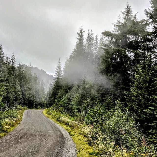
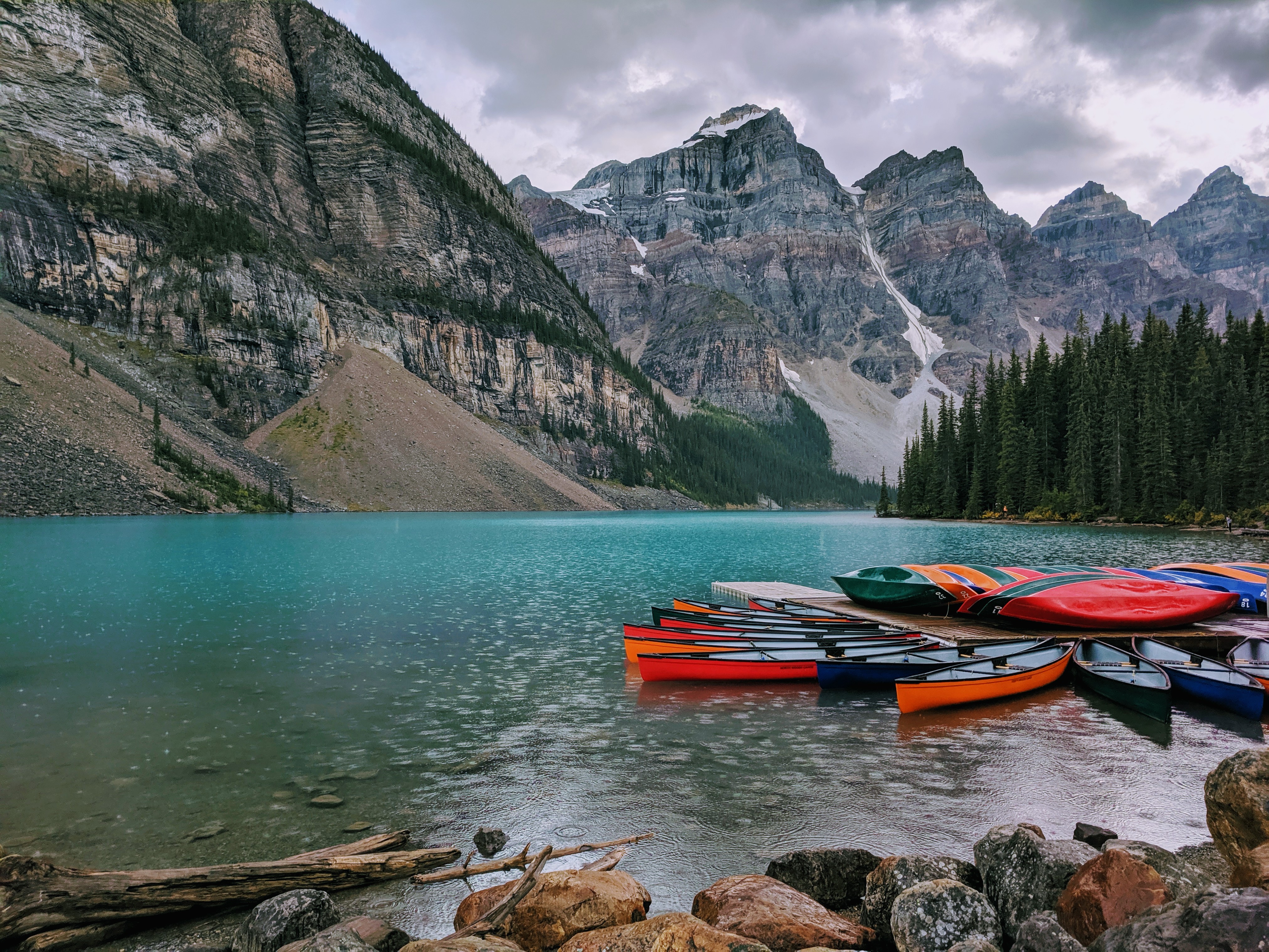
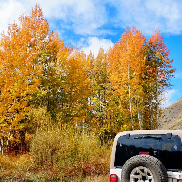
The Sunday stills photo theme for this week is the great outdoors. Something I don’t seem to be getting enough of this year while we’re in construction mode. However, I’ve been planning to write a more detailed post on how I’ve been able to research and locate many free camping areas. I have developed a knack for finding unique and new to me, great outdoors camping spots. I’ve found a few duds too, but everyone has a learning curve! All my finds have helped me fine tune my steps to discovering camping areas in an unfamiliar territory.
We typically focus on finding boondocking sites while we are traveling. The first year was definitely a struggle as I learned new applications, maps, review sites and what works best for me. As I sorted out a research and execution workflow, the road trip planning work has been much easier and faster.
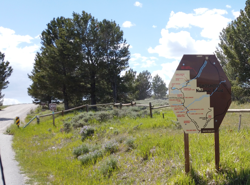
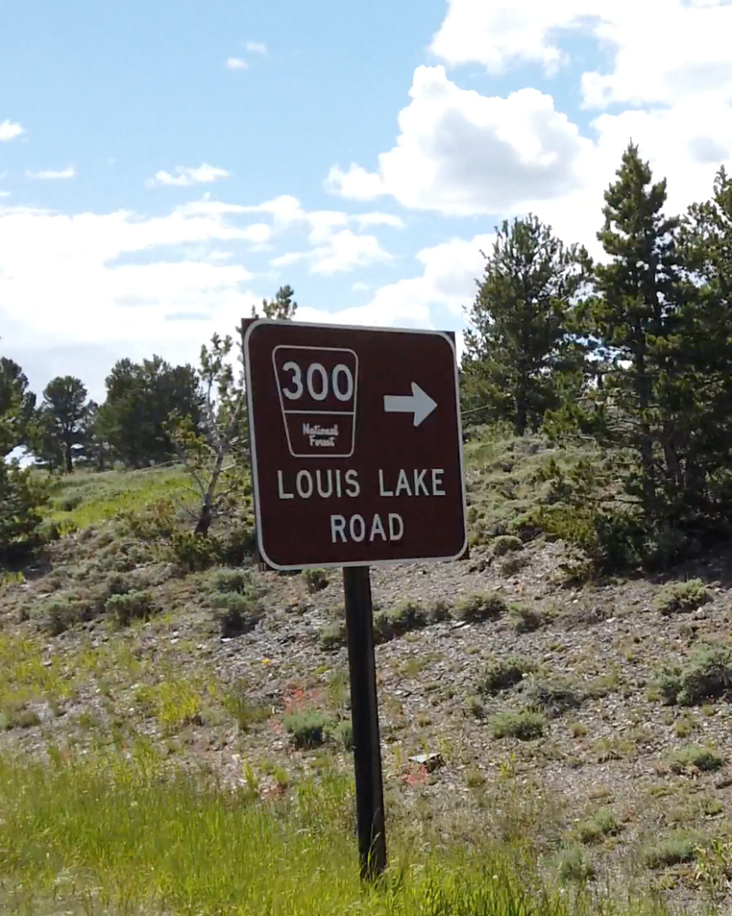
And, in general, we’ve had a high success rate, if I say so myself. Back in 2022, we discovered Louis Lake Road in Wyoming. Finding this area is what I’ll use as my example to outline the steps I now use to locate our dispersed camping areas.


Our Unicorn Camping Spot Defined
Being in a self contained Truck Camper means our unicorn will be different than others. We just want a comfortable, scenic parking spot in an area with outdoor activities and/or sites.

It’s an area that offers us shade from the heat, but enough sun to top off our batteries. Roomy and spread apart sites for both privacy and quiet (we really don’t want to hear a generator). Things to do in the area whether it is hiking, a kayak area, an attraction, a city with site seeing or something else we enjoy. And the topper is to have internet access. I know, some purist will say why do you need to be connected? Isn’t the whole point to just be disconnected. Well, when you’re living in an RV/camper like we are, we conduct our life from the road and it’s actually more relaxing to keep our digital life organized on the fly rather than chase down connections. It’s also entertaining to have some social contact and streaming media. That being said, we’re always happy to disconnect and disappear for a few days.
TIPs: Finding Dispersed Camp Areas
Through trial and error, I seem to have a figured out how to locate new to us dispersed camping. Dispersed camping is free camping on US public lands. Public lands being USFS, BLM, Fish and Game, Bureau of Reclamation and other agencies. This is mostly available in the western half of the US.
Sounds great doesn’t it? Financially it is awesome. We spend anywhere to $0 – $100 on camping sites a year. That covers 5-6 months of travel. But combing through the various USFS ranger districts for maps is not an easy starting point.
Where to Start
I have a couple of starting places. Usually our driving routes are tied to an eventual end destination. That helps as it means I have a general direction to work with.
The First Pass Includes
- Start with Google maps to look up a route from current location to end location
- Note major roads, cities, national parks along the way
- If I’m completely unfamiliar with the area, I’ll start with campsite review sites.
- Campendium, Freecampsites.net, iOverlander and various others will give me a general sense of what camping is available along my main route
- For long drive days or just 1 night of parking, I’ll use Harvest Hosts/Boondockers Welcome. They have great options for just a quick parking spot versus a camping spot. That same holds true for a Walmart, Cracker Barrel, Cabellas type stay which you can find using Allstays.
- Finding a camp area in Campendium, for example, I’ll save the GPS coordinates and look up the area on Google satellite maps as well as my OnX-Offroad map. Using a larger screen is necessary here so you can zoom in and scan along forest roads. You’ll find more established campgrounds which make good back up plans.
- Looking at the satellite maps for a specific forest area, you can typically identify pull offs, spur roads, and even campers.

After I’ve decided the area seems viable, I gather what’s needed for navigation to the unknown. By viable, I mean, it has more than 1 pull off, has obvious dispersed sites, no strong negative reviews, not too many reviews (indicates it may not be too popular). I usually pull together multiple options or fall back plans such as an established campground.
Setup Navigation
I’ll start with simply pinning the location or pin the driving route. If I need more detailed plans, I utilize a google sheet to log all my options. My log includes names, GPS, address (if avail) and source. I have google sheets sync’d to my phone and tablet for offline reference while we’re driving.
Using Google Maps
We use Google Maps for navigation while driving. This works well up until you get onto forest roads. On the forest roads or trails, there’s a 50/50 chance it fails to navigate correctly.
- I’ll scan the satellite map and log for a probable “last” dispersed camping pull off. I’ll click on my map to add a map pin and shows the GPS coordinates.
- Save those coordinates to my planning sheet
- I also save an offline google maps on my navigation phone in case we get out of service range
We use Google maps for our driving navigation. I’ll do search for my “last” dispersed location option and set that as our driving route for the day. TIP: Always double check the last portion of your driving route against the off road map or even a paper map to make sure it isn’t trying to use unmarked roads.
Using an Off Road Map
We use OnX-OffRoad maps every time we’re planning to not be on at least a county highway or city street. Even with the trial version you can download maps offline which is how I started. Once, I knew this mapping tool worked well for me, I upgraded it to PRO and have unlimited downloads. I’ll start with using the web version on my computer and then my saved “pins” or Waypoints will sync to my phone.
- In OnX-OffRoad maps and will download the map area to my phone of the area so it’s offline
- Using my saved coordinates from either a specific campsite review or/and my Google satellite map pin, I’ll search and create a new Waypoint
- Zoom in and review the OnX-OffRoad map details. Once zoomed, campsites will be referenced that can also be used for navigation.

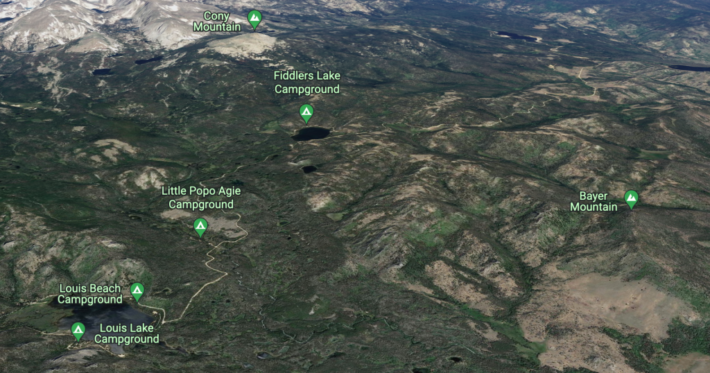
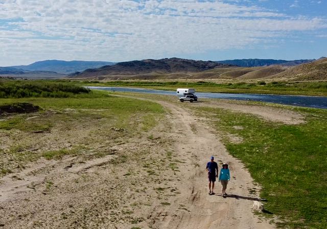
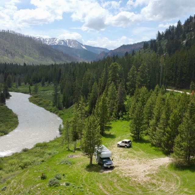
In the map image above:
- The YELLOW “X” is my Last Dispersed option that I could identify from the map. If we drove that far and had not successfully found a site we’d turn around; but if we were still seeing turn offs and campers in the area, we might continue to look.
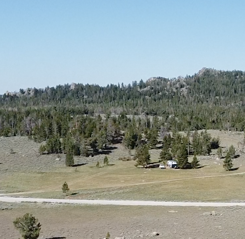
- The BLUE “TENT” is where we actually ended up camping
In between the last option and where we camped were at least a dozen camping areas. When we drove up to the pass later during our day we found many more camping sites along the Louis Lake Road. There were many sites sitting back from the main road that were not visible viewing a satellite map. The maps can’t show you everything and allowing extra time to hunt for a spot is usually necessary.

Additional sources of information include:
- USFS maps online and paper from the range’s office
- BLM maps
- NPS.org where to stay details especially if you’re focusing on a national park visit
- Trail heads, recreational and OHV areas can be useful
- OnX Off Road or GAIA apps for filtering out land ownership and off road trails
- Many websites and mobile apps now exist which is helpful for finding reviews
Camp Review
Here’s a more detailed post on the actual camp area. Scroll down for more on our stay in this area.
Get Outdoors For…
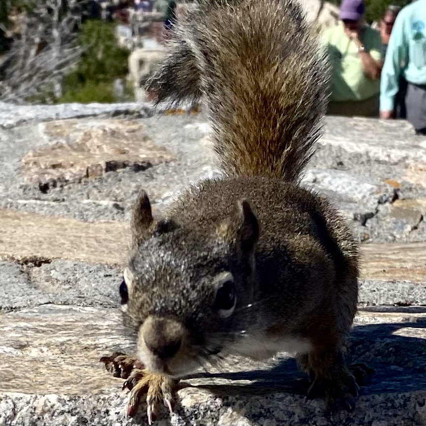
Trail runs, kayaking or SUP, wildlife viewing, hiking and nature! Drop me a comment and tell me how you find your favorite camping or outdoorsy spot.


About the Photo Challenge
A weekly themed photo challenge hosted by Terri. Check out her Blog and come back to visit for more SundayStills and traveling posts!
More Sunday Still Posts
Thanks for visiting our travel blog and I hope you enjoyed finding the #SundayStills Challenge. You can join the weekly challenge by visiting our hosts blog Second Wind Leisure. and checking out Terri’s post for this week, Great Outdoors Month is Now.
If you enjoy personal travel stories and especially camping, follow this blog by entering your email below. You can also follow us on Instagram @WorkingOnExploring or @Maximus.4×4.camper, and subscribe to our WorkingOnExploring YouTube Channel on for our build and trip clips. Good luck on your own exploring and we’ll see you from the road somewhere soon!
Follow WorkingOnExploring travels and ongoing #SundayStills photo Challenge Posts
Delivered directly to your email inbox.

It’s hard to imagine how we managed our trips before the internet. Since we don’t travel by RV, I’m not familiar with all the apps you mentioned, but we also have a few that we wouldn’t leave home without. I still want to have a paper map with me, though… I’m old school that way. 🙂
LikeLiked by 1 person
It’s always great to spread out a large map and see your route in context with the bigger picture. We have several Gazetters that I do utilize if it’s completely new territory. When we first traveled the paper maps were necessary. We’d continue to end up in no service areas and our navigation system would send us off on the wrong road. Now offline mapping has improved and I rely on it a lot. It’ll be interesting when we head to the East coast and see how well our service and offline digital mapping works for us; out in the SW it’s no longer an issue.
LikeLike
Thank you for all the great info. Enjoyed the photos too. I had never heard of boondocking until I started following a few people who do it regularly.
LikeLiked by 2 people
Kirstin – you’re welcome! Finding non established camping spot on public lands can be intimidating but fortunately it ends up being rewarding (most of the time). It’s gotten easier as we’ve established both a set of good finds and areas plus there’s more information out there.
LikeLike
You are so resourceful, Cheryl, and I appreciate how you shared your process for finding free spots. You definitely have the advantage with your specialized camper. Lately our road trips have been by car, on a tight schedule or driving south to avoid cold Januarys, which means motel overnights and then staying with family.
However, I do like exploring KOAs for our trailer, with hookups and the like, since we need access to some of those amenities. Our next RV trip isn’t until October as we travel to NW Washington for a family wedding. We’re already booked in a KOA in Winthrop, partially to avoid kennel expenses and stress for Brodie. While we are at the wedding festivities over the weekend, Brodie can hang out in the trailer, like home. He would howl in a motel or scratch up the place I’m sure.
One of these days, we would like to take the RV cross country, so your info would be super helpful!
LikeLiked by 1 person
We’ve also been hoteling it more and just driving the small pickup to family locations or back to CA; saves in fuel and time to not bring the whole house with us just for a 10-12 hour drive! Having pets travel with you is a big reason to us the trailer. Cooper was always most comfortable just napping in the camper as we went out and about. Brodie will be happy to be in his “home” awaiting your return.
It’s good he’s comfortable and not anxious while you’re gone.
We haven’t even really been cross country yet. The furthest drive was to my Dad’s in Michigan. That’ll change this fall as we head to Massachusetts in September. Since there’s less public land out that way so I’m already pre-planning our stops and marking dates on when I can book any needed reservations at campgrounds etc.
LikeLiked by 1 person