
We’ve been in Idaho for a couple of weeks and it’s time to head back to the shop. Business and a list of camper projects need to be taken care of. Fortunately, I had a few extra days to work with and was very excited when I located a trail route we could travel for 2 days and really escape.

Camping with absolutely no one around?
We tend to do this more often than not. Now, with Maximus we’re even more confident in the rig to travel dirt roads and trails to see areas that may not only be unique but they are less impacted. I wasn’t even sure how to find an interesting route until I found a long 109 mile featured trail in the OnX-Off Road map.
Tools and Steps to find Remote Roads / Trails
It isn’t easy finding unknown routes off highway and it can take a few different apps, websites, and maps to build out the plan and understand contingencies. For this trip, I posted my specific steps at the end of the post.
Leaving Idaho
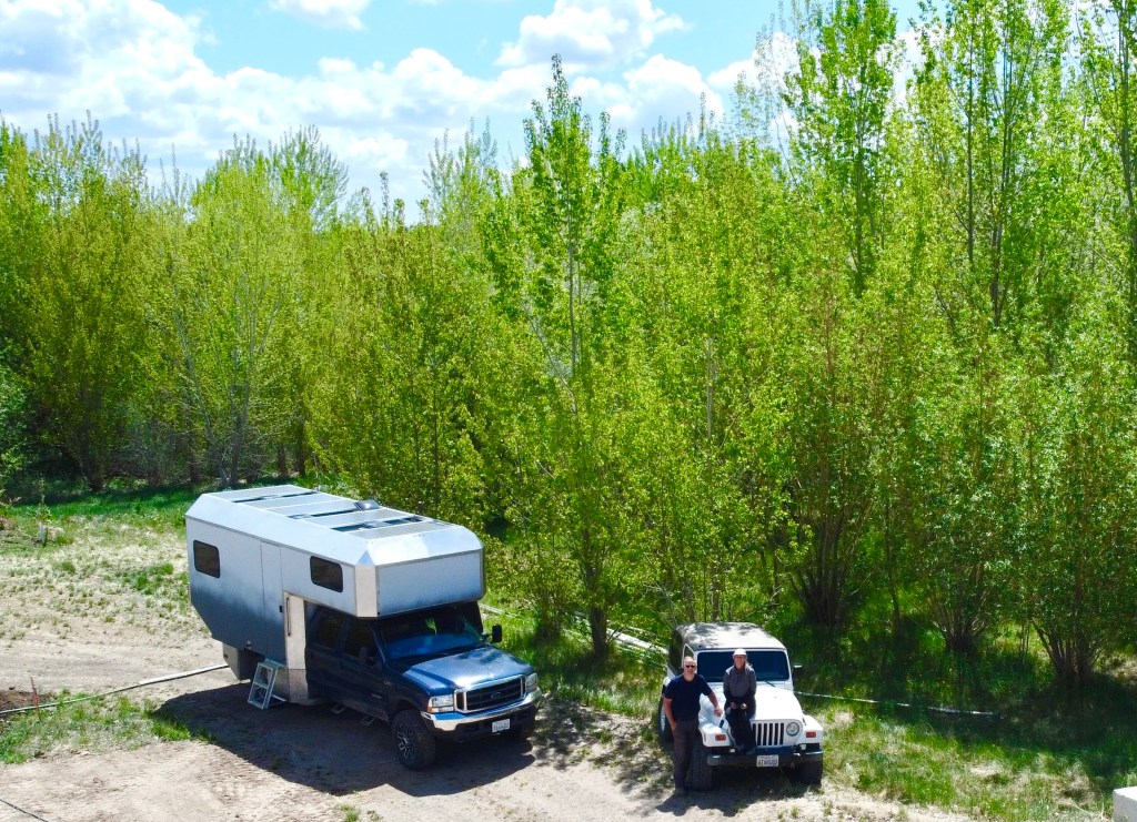
We’ve not mentioned what we’re doing in Idaho! This was a working trip; definitely no fun going on over the 2 weeks we were here. We will eventually be migrating here to a new home base. For now, I’ll call it our 2nd home. Well, not quite a home yet. It’s a future home site that and we’ll be building hopefully next year. We just drive the tiny house on wheels aka Maximus to the property and we have a comfortable place live.
Now that the snow is gone and spring is here it’s time to do some clean up and setup a self sufficient irrigation system. Fortunately for us, this is not a barren home site; there are a ton of trees and plants on this site. There was 2 weeks worth of work to get not only the irrigation in place but also just be familiar with the site, meet a couple future neighbors, stake out the building footprint and just love the creek.
Here’s our route
Let’s get going. The full route back to Southern California takes us in a good direction through Nevada. The trail was a fun and interesting drive. We both loved the escape into an area with no one and getting unplugged. From Wild Horse area we were on smaller 2 lane highways. They were easy to drive and light traffic. So until our 5th day we were safe from faster and more congested interstate roads. When you want to enjoy the journey and not just the destination, this is one formula that works well!
In this post, I cover the first two days on the trail and our camp finds. The 2nd half of the trip and overnight camp areas will be in a follow-up post.

Here’s the OnX Off Road Trail Map with Camp location #1 depicted on the map about mid way. The 2nd night we just stayed down near the end point.

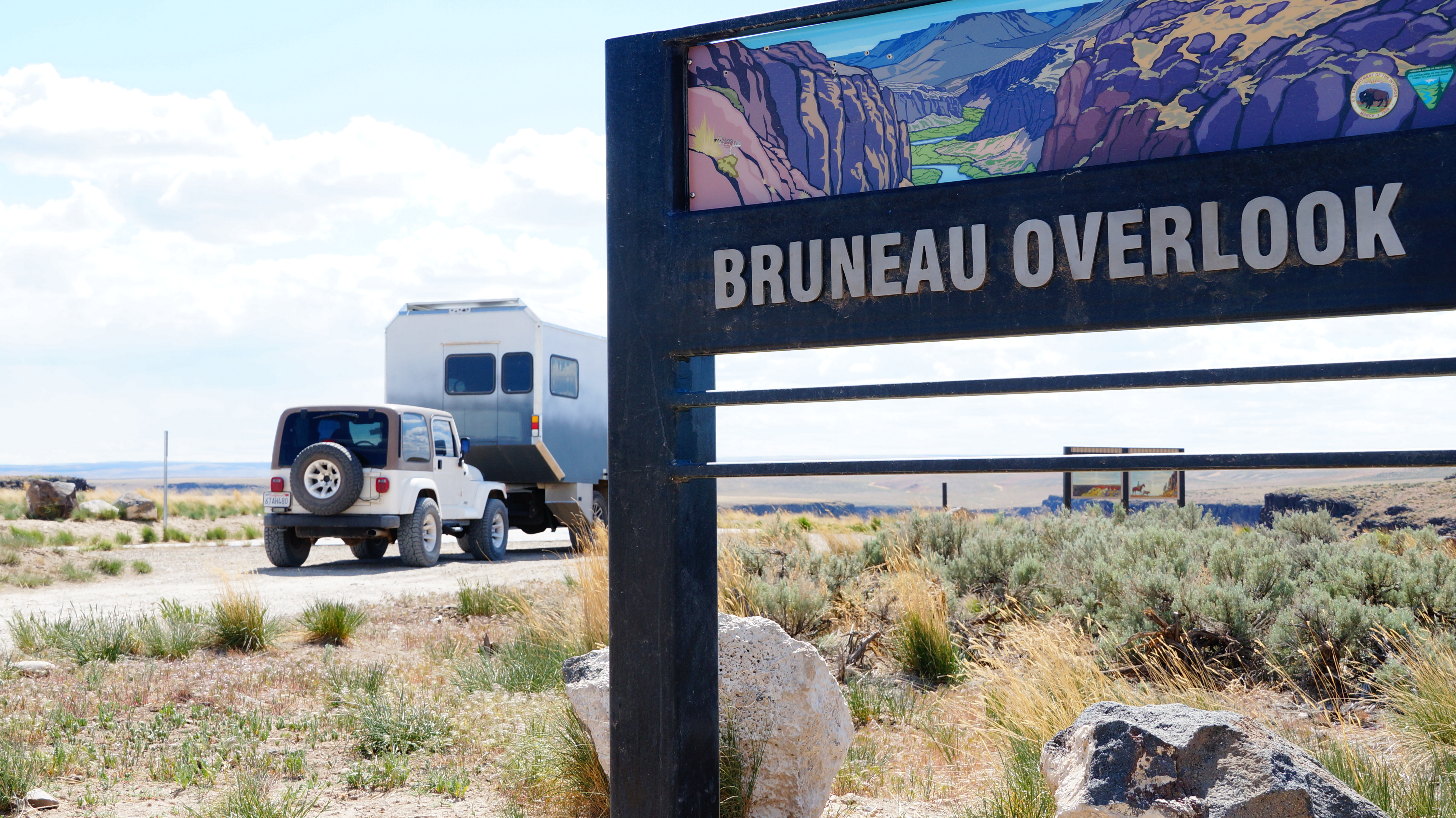
Bruneau Canyon Overlook
Our afternoon break stop was to this canyon overlooking the Bruneau River. Known also as the Grand Canyon of Idaho. It reminds me of Malad Gorge and even our recent Crooked River stop in Oregon on our ep:1 Maximus Travel post and YouTube Video.
There’s very little scenery to see on the drive into the overlook (and afterwards for miles). Our route continues back on the main road we were traveling. We pass through a military range and eventually a handful of ranches and cows. Mostly flat and still boring!


Jarbridge Recreation Area
This was our first overnight camping destination. Looking at maps doesn’t always help me envision what the area will look like.


Jarbridge Recreation Area is the starting launch point for a 69 mile water trail. The raft staging and launch area are across from our camp ground. There’s a vault toilet, a couple tent sites with fire pits and additional parking. The posted map shows that the water trail runs through many class III and IV rapids over a 69 mile stretch back up and pass the Bruneau Canyon Overlook, our first stop earlier in the day.
It’s a very well maintained area with raft launches and easy water access. I don’t think I’d do this specific water trail. As a rafting virgin, I’d opt for something less exciting.
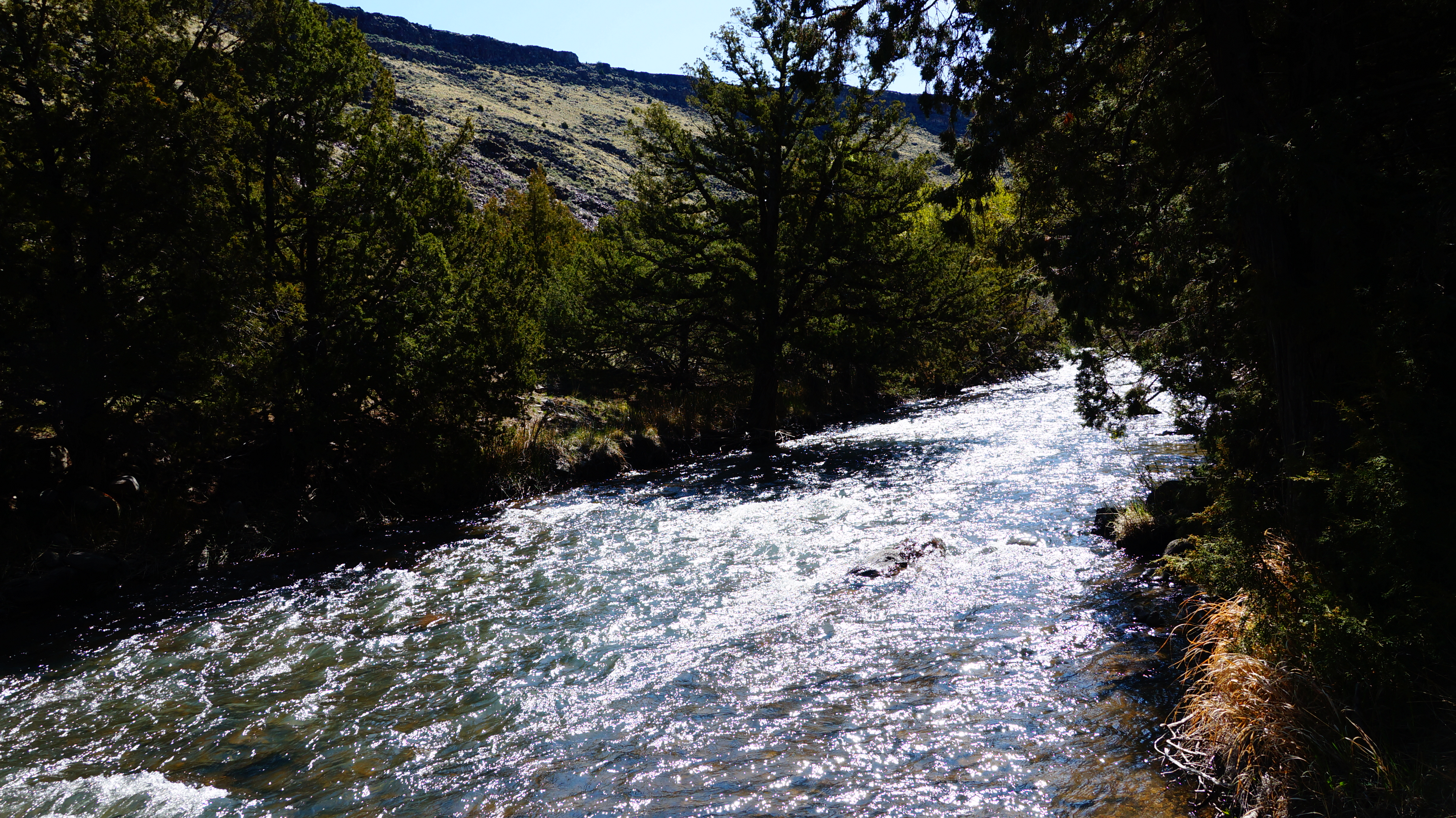
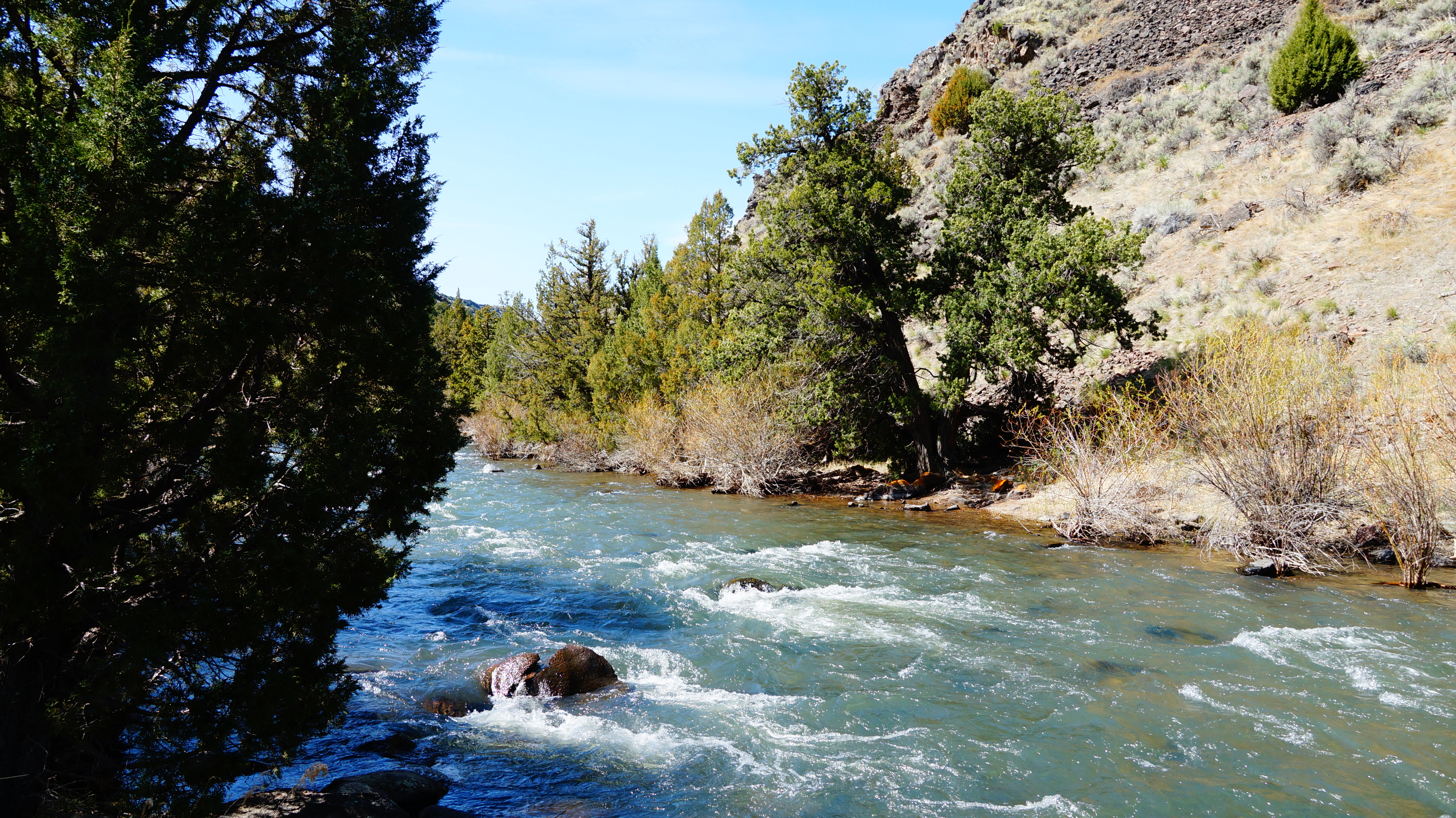
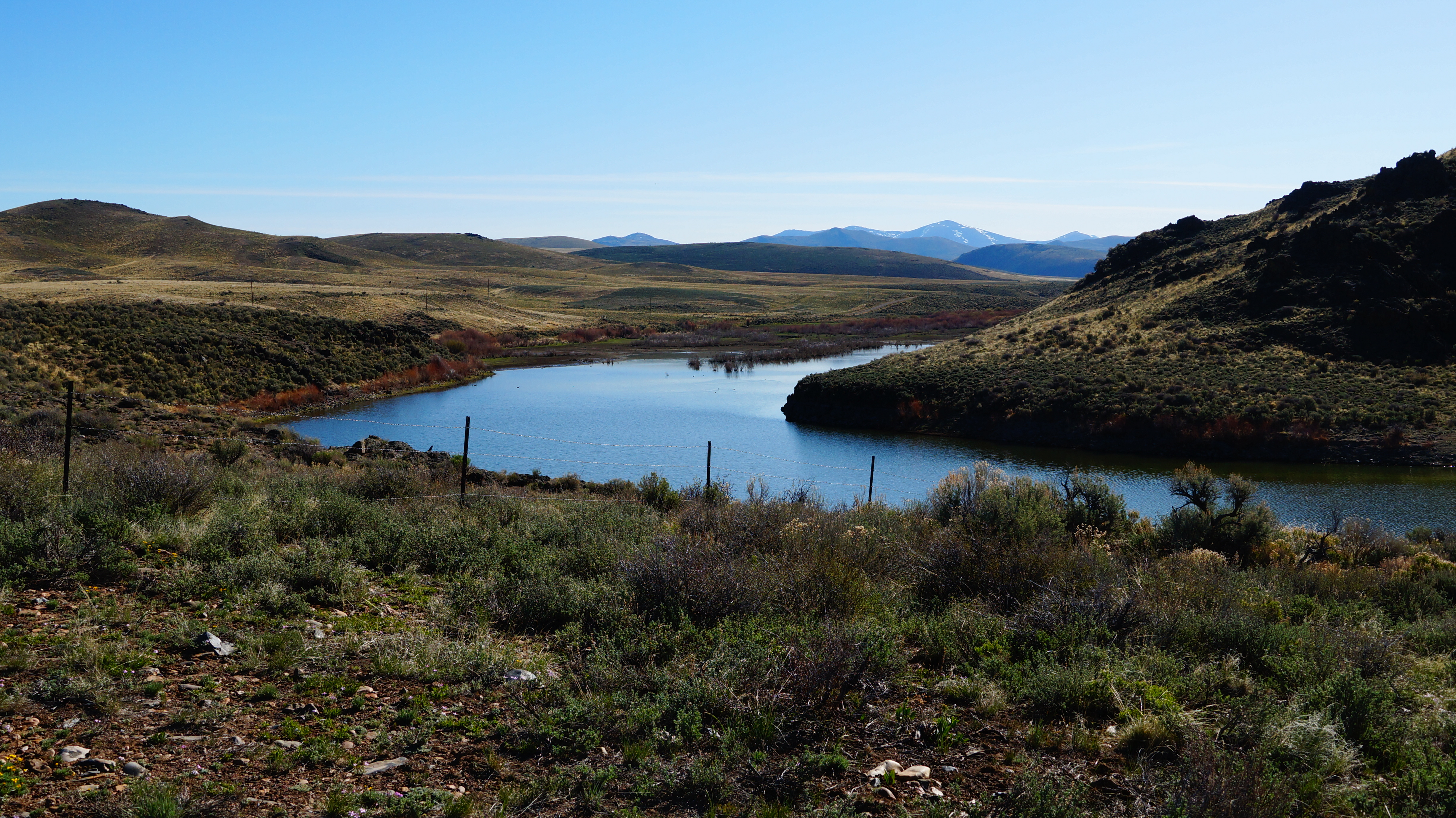
The Forks
The Forks campground, named for the two rivers, Bruneau and Jarbridge, converging here, is a small camp area. There were 4 to 5 sites best suited to cars/tents or a van / truck camper sized rig. There’s no facilities here other than the vault toilet across the road in the main raft launching area. We had the area to ourselves and I always enjoy having water outside our door. The river access here was well maintained and easy to navigate a raft into the river straight from camp.
Trail Driving Route Day 2
We continue through Jarbridge Canyon a little further. I actually missed one turn and realized it about 1/2 mile later. Fortuntely we were no longer towing the jeep and were driving separately. After retracing our steps, we turn into another canyon ascending towards a very scenic plateau area.
Day 2’s drive was very scenic and other than passing one other vehicle, had the road to ourselves until lunch time.
Wild Horse Recreation Area

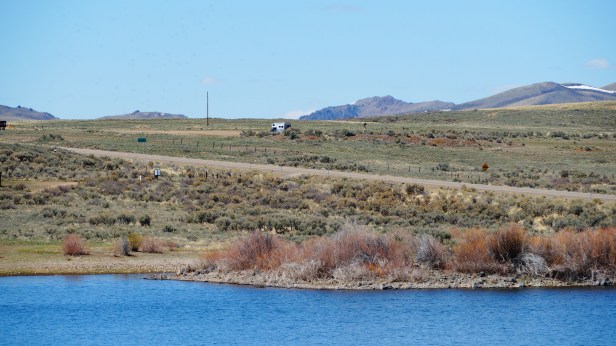
Wildhorse area was our 2nd night and the end of the trail run. The camp area I had mapped was a staging area for OHV, horses, etc. It was just opposite the Wild Horse State Recreation area fee entrance. The stopping point was unattractive and near the highway but was free and just for one night.
Since we were early, we unhitched the jeep to check out a few other camp options around an area of the reservoir. We could see rigs in what looked like dispersed camp areas just down the road. Turned out that all camp areas around the reservoir are fee based at $10 / night for dirt and $15 / night for paved sites.
Trail End Point
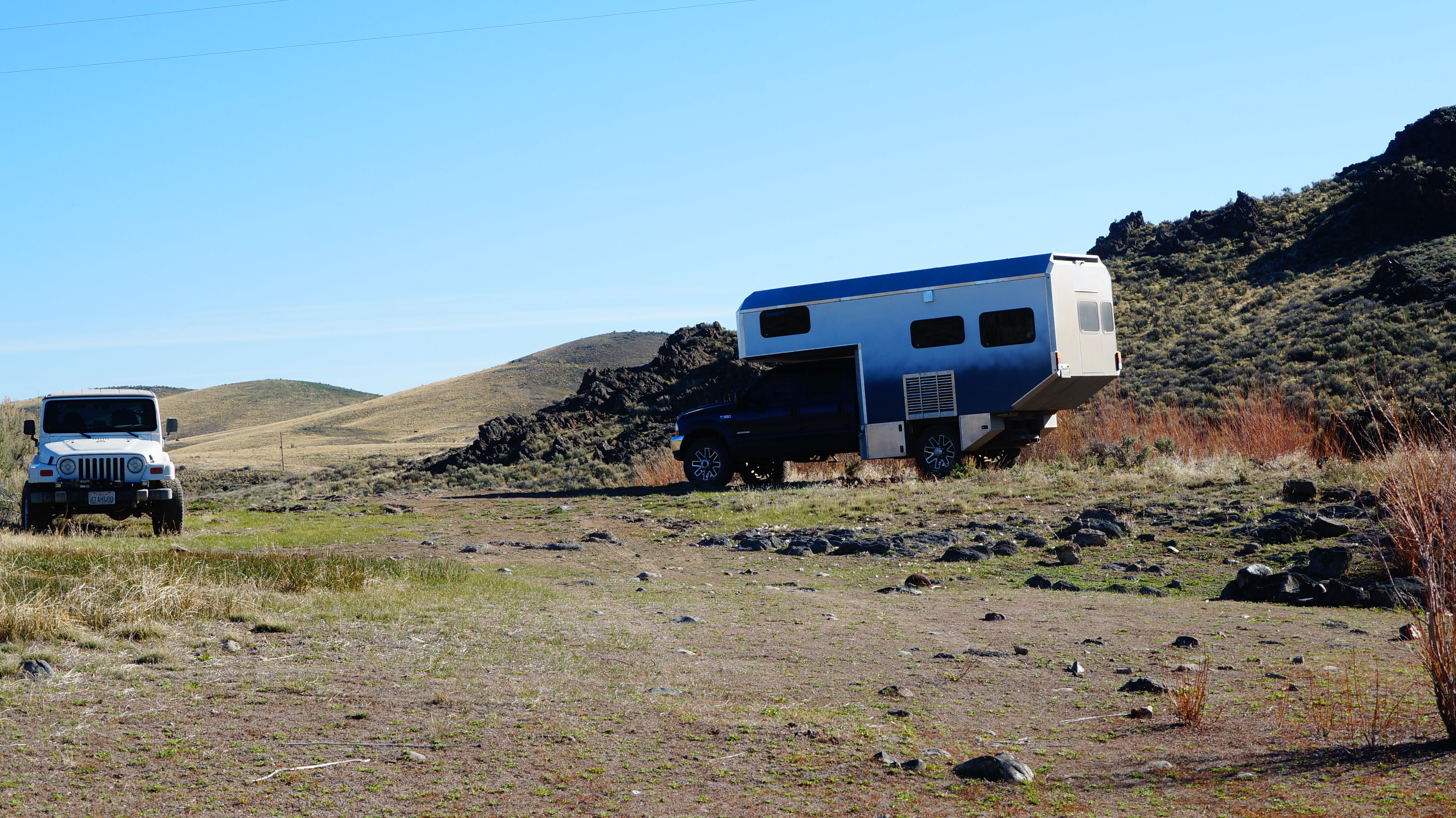
The stopping point was unattractive and near the highway but was free and just for one night. This is the view back to Maximus parked at the end of the trail parking lot. Highway 225 is the visible road.
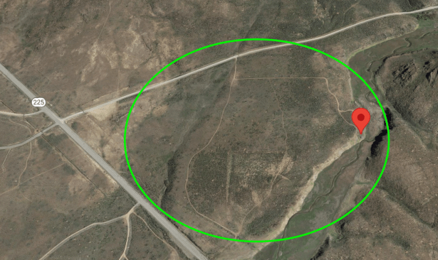
As we head the Jeep back to the camper, we noticed a dirt trail down to the water just south of where we parked Maximus and outside the recreation area. After a little exploration, we found additional dispersed camp sites that were further from the highway and were calling our name. They were level enough and we enjoyed a nice night on the water with the geese as our only companions.
Surprise Find
As we head the Jeep back to the camper, we noticed a dirt trail down to the water just south of where we parked Maximus and outside the recreation area. After a little exploration, we found additional dispersed camp sites that were further from the highway and were calling our name. They were level enough and we enjoyed a nice night on the water with the geese as our only companions.


I do need to note that I was and am still a little unsure if we were on BLM land or Burea of Indian Affairs land. And, if we were not on BLM land, were we technically allowed to camp where we were? I know we were not on private property. Although there were obvious camp sites present, that doesn’t always mean it’s right to camp in the same location. My OnX Off Road map layers for this trail appeared to be shifted making the ownership unclear and I didn’t have reception to go online and check with other tools or web sites.
Video – ep:4 – Adventure Camping and 2 Day Trail Drive
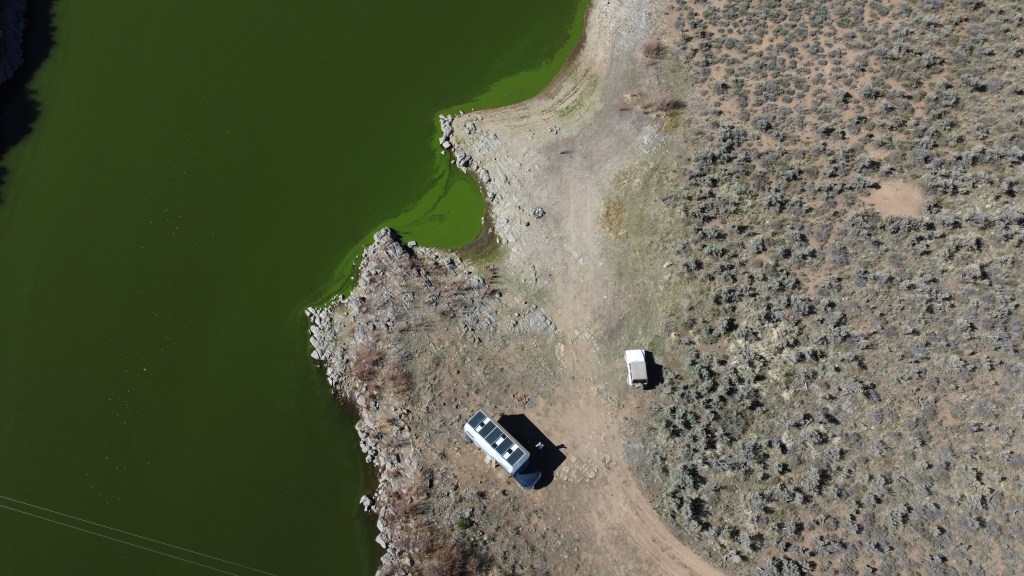
Watch the video and drive the trail with us. The camp area images in this post and in the video are from our first few drone flights; we are both enjoying using the drone and getting comfortable with letting it fly.
What’s Next?
2 more travel days and interesting camp finds coming in our next post (and video). Then we’ll be in the shop and getting a few major and many minor Maximus projects completed before setting out mid June. That’s the trip with no specific end date…what a concept!
If you enjoy personal travel stories and especially camping, follow this blog by entering your email below. You can also follow us on Instagram @WorkingOnExploring or @Maximus.4×4.camper, and subscribe to our WorkingOnExploring YouTube Channel on for our build and trip clips. Good luck on your own exploring and we’ll see you from the road somewhere soon!
Follow WorkingOnExploring travels and ongoing #SundayStills photo Challenge Posts
Delivered directly to your email inbox.
Tools / Tips – Steps on How I Found our Trail and Campsites
- In OnX Off Road, I simply scanned the area and direction I was planning to travel
- I saw a Featured Trail (BLUE+GREEN lines mark it) and tapped the trail for additional information
- Located the north end of the trail which would be our starting point (Bruneau Canyon Overlook)
- Located the south end of the trail for our ending point (outside of Wild Horse Recreation Area)
- Noted the GPS coordinates of both ends
- Using Google Maps look up directions to the starting GPS locations
- Where possible double check the roads / streets are valid
- Scan satellite map layer to see if roads look viable
- Map directions in google to the ending GPS location and also scan.
- My Error: I didn’t not recognize how different the google roads where versus the trail. This happens especially when using a mobile device’s small screen which is challenging to zoom in and still compare routes. We would’ve been lost multiple times if I didn’t have the OnX trail map tracking us.
- Finding Camp Sites:
- Using both tools (Google maps and OnX Off Road map and others such as iOverlander, The Dyrt, Freecampsites.net, scan for camping locations along your route, BLM and Forest Roads. This can take time and for me using a larger screen is very helpful.
- I don’t recall if either of my destinations showed up on a camping review site however google maps had reviews of The Forks that I located on OnX Off Road.
- The 2nd camp area was simply BLM trail head land and made an assumption it would be usable but if not, I’m in an area where there’s paid camping and potentially dispersed camping for us to check out.
- Camping
- 1st night: OnX map showed a few camp locations so I just picked the one that showed up on google maps and knew I’d have a couple others if it was a bust
- 2nd night: The end point landed us in a large reservoir area with a few fee camp areas. We always try to find free camping or pull offs and the trail ended at a loading area for OHV and/or horse trailers. Knowing there was BLM land around, I was hopeful we’d find something much more attractive once we arrived.
- 3rd night: iOverlander provides a quick view to spot wild camp areas which is all we needed. A BLM area along the route was planned. Then I use google maps to confirm driving route and duration; make sure it’s viable.
- 4th night: Same approach as our 3rd night, but this time I checked through a few other review sites such as Campendium and Freecampsites.net for options. Our mid point would put us near a major highway and outside of Las Vegas and I found references to dispersed mountain camping NE of Las Vegas and just about our midway point.

I have lived in Idaho my whole life. Funny thing is Bruneau is less then hour from my house and we have never been to the canyon. Two years ago we ended up, North of were you were, or the lower end of the river before it dumps into the Snake river. We found a gravel pit by the side of the road and it made a great camp spot. It was hot, so we went to the river. What we found was craw fish and muscles. Always nice to come back to camp with supper after cooling off in the water. We spent two days exploring in the UTV.
Thank You for sharing your build and adventures. This morning I am going to pick up a 30 foot dry van trailer to begin my second camper/RV build.
LikeLiked by 1 person
What a great story and we all tend to set our adventuring sites far beyond our backyards, don’t we? Sounds like a fun project to keep you busy. Good luck with the new build. We have a lot in Gooding we hope to break ground on this year. Of course, the shop build is the priority!
LikeLike